You set the region
Record the area each camera covers. The model rules out species that can't occur there, so labels start closer to right instead of guessing from a global list.
Product
One workspace for your wildlife work, from a single camera to a fifty-camera grid. Upload your footage, let the AI find and label the animals, and review what it's unsure about. The results show up on a dashboard and a map, or in an export that stays yours. Hosted in Europe.
Test the platform: add a project and a camera (FTPS or manual upload), and work through review, dashboard, and maps on your own footage.
Getting set up
From a new account to your first detections — set up your own project and cameras, whether you run one site or a multi-camera program. Run it in our European cloud, or self-hosted under your own brand.
Create your organization, then add a project per site or grid — forest, reserve, farm, estate, or research area — so multi-site work stays structured.
Two ways in, both fully supported. The simplest: upload it yourself — drag in files from a computer or an SD card, nothing to configure. Or let connected cameras upload automatically over FTPS (preferred) or plain FTP, each with its own login. Many sites have no connection, and the platform doesn't need one.
Wildlife AI labels species with confidence scores. Clear the review queue for uncertain detections, then use dashboard, analytics, maps, alerts, and export.
How the AI works
The species recognition is our own wildlife AI, built for European species and hosted in Europe. Two things you do in the platform make it sharper on your own ground, and you can run it on infrastructure you control.
Record the area each camera covers. The model rules out species that can't occur there, so labels start closer to right instead of guessing from a global list.
When a capture is uncertain, you look at the actual image and confirm or correct the species. That frame-level review is where recognition gets better, not a slider you never see.
Every region you set and every correction is a signal we use to improve the model, so it keeps getting better on the species you actually see. The empty, false triggers still fall away before they reach your dashboard.
For sites the cloud can't easily reach — the Smart Wildlife Box. A research and development project putting lightweight edge AI near the camera to send only the frames worth keeping, so low-power, off-grid, or many-camera sites get on-camera smarts while full recognition, provenance, and export still run in the cloud. Read about the Smart Wildlife Box →
Capabilities
Everything you need after the camera fires — from organization structure to export — in one private workspace.
Structure work as organization → projects → cameras. Run one site or many programs side by side without mixing folders and spreadsheets.
Per-camera FTPS/FTP credentials, GPS, activity status, and media counts — or upload footage yourself from a computer or SD card. Both paths are equally supported.
Each camera reads green, amber, or red on recent activity and last upload, so a trap that has gone quiet in the field surfaces before you lose a season of data.
Photos and videos are analyzed automatically — animals detected, species classified, with confidence scores. Processed on European infrastructure alongside your footage.
Low-confidence detections wait for a person. Confirm or correct species — including bulk actions — and keep corrections for audit and quality tracking.
Set your country and the AI stops offering species that can't occur there — fewer impossible labels, and less to correct in the review queue.
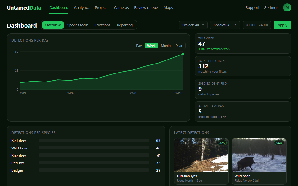
Daily glance: filter by project, species, camera, and date. KPIs, trends, species charts, gallery or table, and presets for overview, species focus, or reporting.
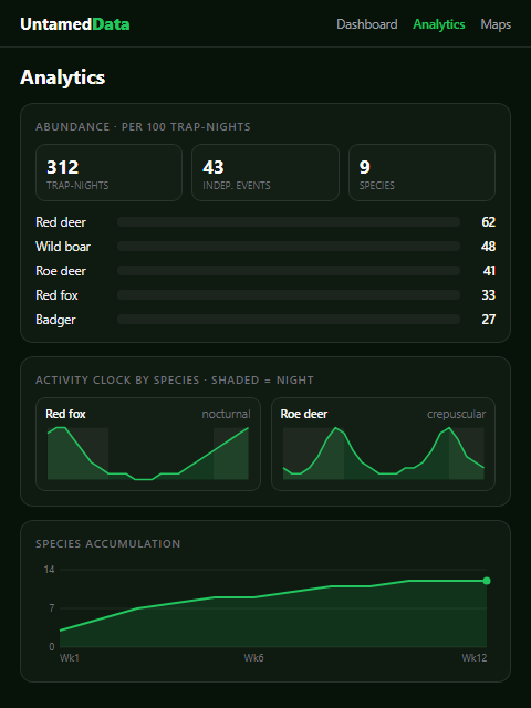
Abundance (RAI), activity clocks, survey completeness, and species-by-location patterns — the ecology measures a monitoring program reports on.
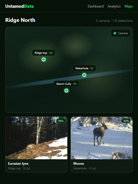
Plot cameras (and projects) with GPS coordinates. See detection counts per location and filter by project across a site or multi-site network.
Instant species alerts for the animals you care about, plus optional daily digests — so priority events reach the right people without living in the app.
Download filtered results as CSV for analysis, or a PDF report for a claim, a funder, or a partner, from project scope or across your organization.
Invite colleagues, manage roles, and share projects and cameras in one private organization workspace — field staff, managers, and partners on the same data.
See it in the product
Once the cameras upload and the AI labels species, this is your daily glance — filters, charts, gallery, maps, and export, on a desktop or a phone in the field. Analytics for deeper patterns; Maps for where the activity sits.
Coverage
Every detection carries GPS, so your sites, grids, and hotspots render on a map — not a spreadsheet of coordinates.
Analytics & ecology
A labeled photo is a start, not an answer. The analytics turn a season of captures into the standard measures ecological monitoring runs on — relative abundance (RAI), survey effort in trap-nights, and activity patterns — plus how thoroughly a site has been surveyed.
Detections are normalized to independent events per 100 trap-nights, so cameras that ran for different lengths of time can be compared on equal footing.
A per-species activity clock shows when each animal is on the move — dawn, dusk, or through the night — across the whole recording period.
A species accumulation curve shows how many distinct species a site has turned up as effort grows — and whether new ones are still appearing.
A species-by-camera heatmap shows which animals appear where, so patterns across a site or a multi-camera grid are visible at a glance.
Confidence spread, reviewed-versus-pending, and correction rates — so you know how solid the numbers are before you put them in a report.
Species share, diversity over time, and a predator-versus-prey view put the community in context — useful where a returning predator changes how land is managed.
Field access
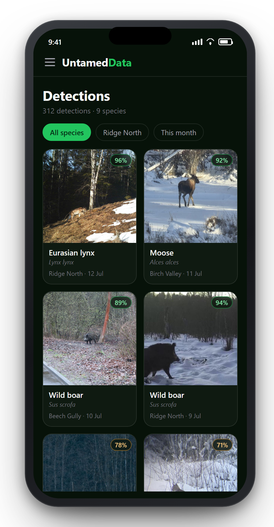
The same organization, projects, and detections — in the browser on a phone or tablet. No app store, no separate install: open the site, sign in, and work from the field.
Built as a field-first web app, not a cut-down demo of the office tools. You get nearly the same functions as on a desktop: check recent captures, open the review queue, glance at maps, and stay aligned with the rest of the team. Layout and controls are tuned for outdoor use — quick checks between stakes, not long analysis sessions on a small screen.
Who it’s for
The same platform, tuned to how you work: wild boar in a vineyard, a predator on a fish farm, a threatened species coming back, or a research grid.
Wild boar and deer on crops and vines. See what's active, act in time, and keep an auditable record for a damage claim or permit.
Read use case → Livestock, land & waterFox, wolf, and lynx on grazing land; otters at a fish farm. Respond with facts, not guesswork.
Read use case → ConservationTrack which species return to forests, wetlands, and corridors, then export charts for funders and partners.
Read use case → ResearchStructured projects, a review queue for uncertain IDs, and clean export you can analyze and publish.
Read use case →Learn more about wildlife AI, supported cameras, and self-hosted or white-label deployments.
European-hosted species detection, review queue, and how our inference pipeline fits your workflow.
Read more →FTPS preferred for secure upload; plain FTP as fallback — brand-agnostic setup for most wildlife cameras.
Read more →Run on your own infrastructure with optional white-label branding for partners and enterprise.
Read more →Why Untamed Data
The short version: European-hosted and governed, camera-agnostic, and yours to keep — no vendor lock-in, no dependency on US cloud AI APIs. Read the full story on why Untamed Data →
Stored on Untamed Data servers in the Netherlands by default — inside the EU, under EU rules.
You own your footage and detections. Export a complete copy at any time and keep it on your own systems — your record never depends on what we retain.
Works with most wildlife cameras over FTPS or plain FTP, or upload footage yourself — brand-agnostic by design, so you're never tied to one maker's app or cloud. Avoiding camera lock-in →
Export your dataset as a Camtrap DP package, the camera-trap field's open standard — so your records stay portable and readable outside our app. Standards & interoperability →
Wildlife footage and detections stay under your organization’s control. Default hosting is in the Netherlands; you can export your data at any time, and uncertain AI results go through a review queue so people stay in the loop. Self-hosted deployments keep data entirely inside infrastructure you choose. See our Privacy Policy for how we handle personal data.
Next step
Test the platform on your own footage. Need more than software? We also do hands-on consultancy, plus self-hosted and white-label deployments.
